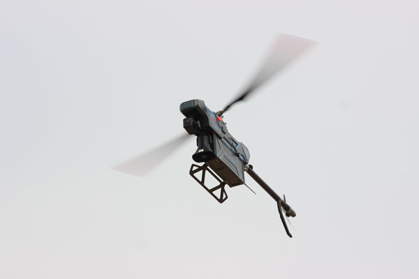
Vertical take-off and landing mode Low requirement for take-off and landing platform Quickly arriving at the designated place for disaster patrol
Remote transmission of real-time Scene, convenient to command, minimizing disaster losses
It can be operated in the disaster Location which is challenging to reach by human and complex terrain conditions which vastly reduce the intensity and impact of emergency investigation of the geologic disaster, rapidly compose on-site information that provides decision making of commanders with reliable and intuitive information
It only needs 1-2 people to complete all kinds of operation tasks, with a high degree of intelligence, simple operation, strong fault protection, multiple protection methods, autonomous and accurate obstacle avoidance in radar detection, and automatic return when losing contact
It supports various payloads, including dual infrared light, night vision camera, oblique camera, lidar, loudspeaker, searchlight, fire-fighting bomb throwerlauncher, etc. According to actual demand, it can quickly change the payload, realizing multiple applications for one aircraft with high adaptability and application.
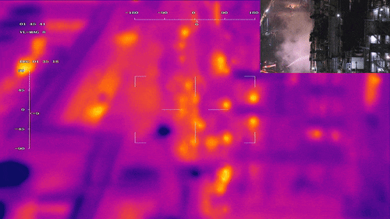
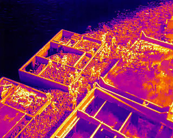
During the emergency, the fast deployment and ultra extended hovering capability to monitor the fire are vital requirements
Nearly 12 hours of air monitoring
Provide accurate location information of high-temperature points
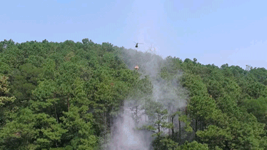
Effective ground air integration to extinguish the fire